

...he pops up with new pics of the Jamaican countryside and fascinating (to him) hydrology information! hahaha. First off, let me just say good riddance to August. It's the month of my birth and I usually love it, but this August was just stressful for me in so many ways and I am not sorry to see the back of it.
Anyways.
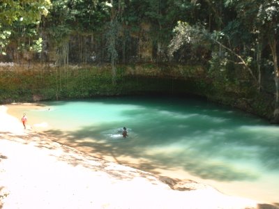
Yesterday, I went on yet another investigation for my job, this time looking at possible sources of silt in the Dry Harbor Mountain basin. Apparantly, there is a hydroelectric power plant located on a river, and they reported having issues with their intake getting clogged with silt that was coming from outside the area, since that silt was all brown and sandy; but the dam is in a marly limestone region with white dirt. The river rises out of this AWESOME blue hole at the foothills of the Cockpit country, and there is at least one known river that sinks about 20 miles to the southeast of the blue hole which connects to it.
So.
We, the WRA crew made our way firstly to the headwaters of this smaller river in Manchester, outside of Spaulding. See the pic with a small river in this sandy river bed (for the life of me, i can't figure out how to put these pics where I want them to go.) We didn't actually go to the actual headwaters, but stopped off right below where it pops up. Some Rural Water Development people are building a treatment site near there, so we checked it out to see if it could be a potential silt site. It COULD be, but with the relatively small volume of water at this location, I wouldn't hold my breath on it. The soil here was pretty hard and clayey, stuck together.
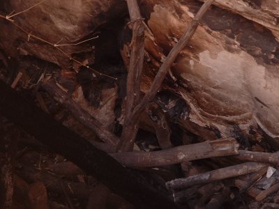
Next, we went to the place where the river sinks into the karstic limestone. If you don't know what karstic means, go ask your geology teacher ;) There's one pic where the river seems to flow right under the limestone outcrop; that's the low flow sink. The other pic with the whole bunch of bambo debris and the other pic staring into a dark crevasse with bamboo debris is the high flow sink...and I would not want to be there at high flow! The debris was piled up from the last major flood event (Hurricane Ivan) and hasn't been cleared yet. As per the course for this place. One note about the crevasse pic; you can clearly hear the water flowing off under the rocks to points known in routes unknown. Where does this water come out? We got a soil sample here, regular river sand...
Then we took a long haul into St. Ann, through Browns Town and into the edge of the Cockpit Country where the Rio Bueno rises up. See the Blue Hole pics. From this point, the river flows to the sea, and gets dammed for useage. We checked it all out, went down to the dam head and the hydro station, saw these two people having sex in the river with no shame, and made our conclusion. Basically, the dam people have to suck it up and build a better intake, plus dredge their dam more often. :)
Anyways, that's what i've been up to. Hope you like the pics...back to lurking and chilling until i get inspired again. Thanks to those who left comments, I only just got them! I will be getting more notice of them now, so please let me know you read all this.
No comments:
Post a Comment